DJI Matrice 4E
Precision Mapping and Survey
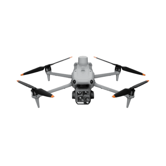
DJI Matrice 4E
Precision Mapping and Survey

Need help deciding?
Our team can help with volume pricing, invoice payment, or any questions.
Product Description
The DJI Matrice 4E is a professional mapping drone that fits naturally into modern agricultural operations. Designed first and foremost for high-accuracy surveying and mapping, it also translates seamlessly to on-farm tasks such as paddock scanning, livestock monitoring, infrastructure inspection, and supporting drone mustering operations.
With enterprise-grade positioning, stable flight performance, and a camera system optimised for survey workflows, the Matrice 4E excels at creating detailed orthomosaics, elevation models, and boundary maps. For producers, that means clearer paddock intelligence, better planning, and more informed decision-making across large and remote properties.
On farm, the same strengths that make the Matrice 4E an exceptional mapping platform — long, stable flights, precise control, and reliable data capture — also make it a powerful everyday tool. From checking fences and water points to scanning country ahead of mustering, it provides a calm, efficient aerial perspective without overcomplication.